
Bridgeport Recreational Trail
This ‘rail to trail’ is an east-west recreational trail built on a former Canadian National (CN) rail corridor. Located between Shell Road and Van Horne Way, this 1.5 km recreational trail travels through residential and industrial areas. Over time, this trail will provide an important link between the proposed Shell Road Greenway and the Bridgeport waterfront.
Note: Exercise caution when exiting the trail at Van Horne Way as it is used by local industries as a truck route.
The closest cycling routes linking to this area are along Garden City Way and Sea Island Way. The Richmond Middle Arm Recreational Trail and Waterfront Greenway is also close by, however access is through major intersections so it may be challenging.
2021 Trails Map Bridgeport Bath Slough
Points of Interest
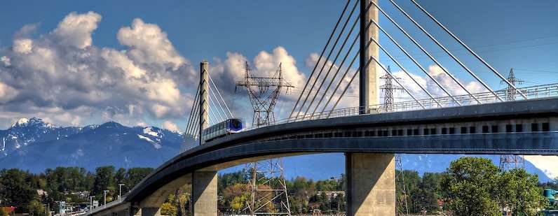
Canada Line Bridge
This iconic bridge connection joins Richmond and Vancouver over the North Arm of the Fraser River providing commuters a fast and 'green' alternative to driving, designed to accommodate cyclists and pedestrians in separate, dedicated lanes located under the guideway on the west side. Access the pedestrian/cyclist lane is from Van Horne Way or River Drive.
River Rock Casino & Marina
This publicly accessible boardwalk and pier extend into the Fraser River providing excellent views of landing planes and evening sunsets. This environmentally sensitive area is located north of the Bridgeport Canada Line station, adjacent to the River Rock Casino & Resort.