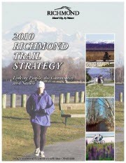
2010 Richmond Trail Strategy
Linking People, the Community and Nature
The 2010 Richmond Trail Strategy was adopted by Council in Fall 2004. The overall vision is that:

Over the years the concept of a trail system has expanded to include cycling routes, walkways, park pathways, expanded sidewalks and boulevards, greenways, blueways and rural roadways. The new proposed trail network is one that encompasses many different walking and cycling opportunities and works towards creating a walkable community in Richmond.

2010 Richmond Trail Strategy
The Richmond Trail Strategy is a comprehensive document that focuses on seven key areas ranging from the Vision and Principles of the strategy to a comprehensive Implementation Plan. Select from the following list of PDF documents to review the strategy area of interest:
- Executive Summary
- 1.0 Introduction
- 2.0 Background Information
- 3.0 The Strategy
- 4.0 The Existing Trail System
- 5.0 Key Opportunities
- 6.0 Neighbourhood and Community Links
- 7.0 City-Wide Links
- Steveston Area Trails (including map)
- Terra Nova Area / West Dyke / Middle Arm Trails (including map)
- Railway Avenue / McCallan Road Greenway (including map)
- Garden City Greenway (including map)
- City Centre / West Cambie Area Trails (including map)
- Bridgeport Area Trails (including map)
- No. 7 Road Trails (including map)
- East Richmond / North Fraser River Greenway (including map)
- Hamilton Area Trails (including map)
- East Richmond / Fraser Lands / Riverport Area Trails (including map)
- Shell Road Greenway / Horseshoe Slough Trail (including map)
- Gilmore Area Trails (including map)
- Sea Island Area Trails (including map)
- 8.0 Design Ideas
- 9.0 Implementation Plan
- Appendix
For more information on the 2010 Richmond Trail Strategy, contact:
Parks Planning, Design and Construction, Community Services Division
Phone: 604-244-1208
Email: parks@richmond.ca

